Projects
Research and engineering portfolio spanning language-conditioned planning, field robotics, 3D perception, visual SLAM, and developer tools.
From field-tested off-road navigation to point-cloud learning and earlier software systems, this portfolio traces a consistent theme: turning difficult geometric and computational problems into tools that work. The newest research appears first; earlier engineering projects remain here as part of the full arc.
Research
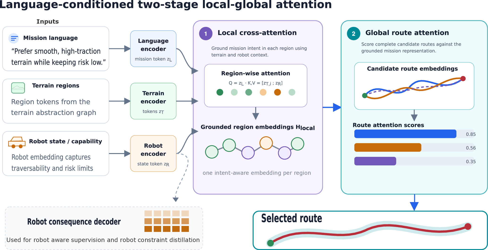
Language-Conditioned Off-Road Planning
Robot-adaptive route planning that grounds mission preferences in semantic terrain and traversal consequences.
Two-stage region-guided planning reduces search states by 75% and candidate latency by 20–22% in the current evaluation.
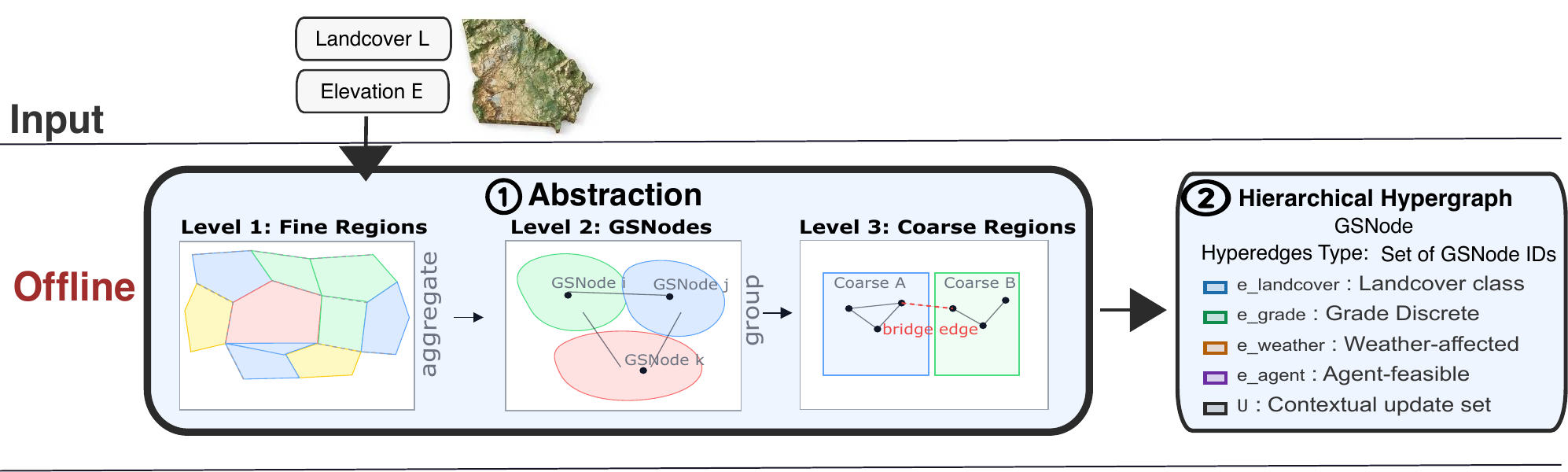
HOPHY
Hierarchical off-road planning with reusable hypergraph abstractions for fast, localized replanning.
68–1,280× faster path queries; validated over 1.5 km of autonomous Jackal navigation.
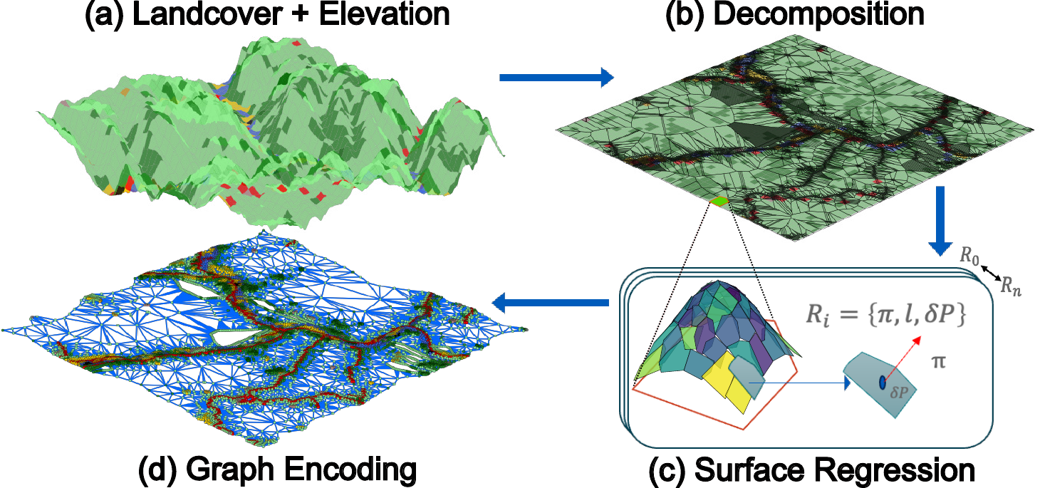
CLEAR
A semantic-geometric terrain abstraction for reliable planning across large, unstructured environments.
10× faster planning with 6.7% cost overhead in the reported evaluation.
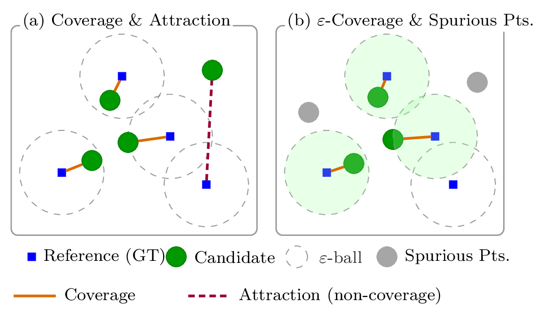
QAL
A quality-aware loss that separates coverage and precision for point-cloud reconstruction.
+4.3 average coverage points over Chamfer Distance in the reported experiments.
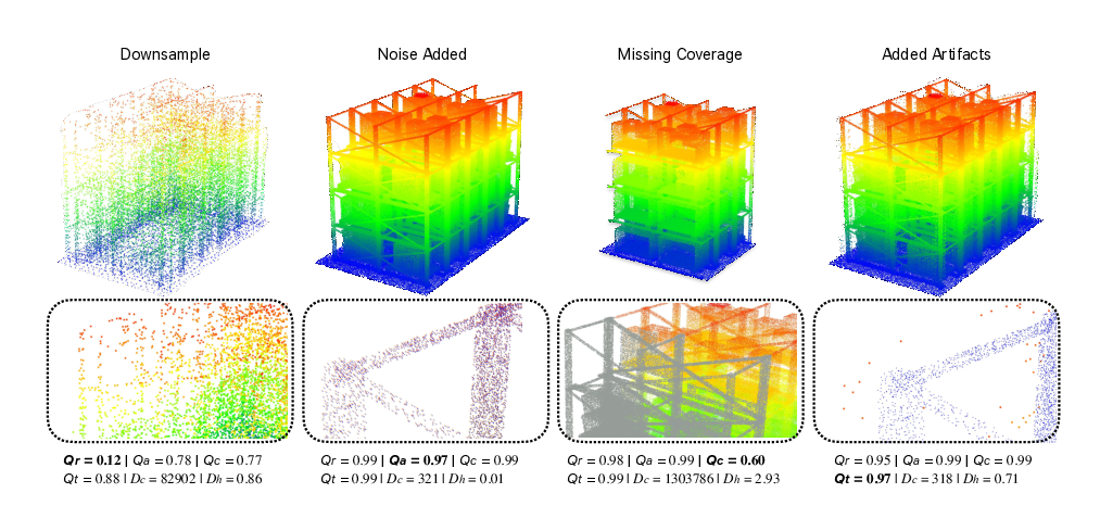
Empir3D
Multi-dimensional point-cloud assessment across resolution, accuracy, coverage, and artifacts.
A four-dimensional view of reconstruction quality beyond a single distance score.
Stereo Depth from Polarization
Self-supervised stereo depth and surface-normal learning for texture-poor and reflective regions.
Multi-objective depth and normal prediction improved accuracy by 20% over the evaluated stereo baselines.
Modular Visual SLAM
A modular, extensible visual SLAM framework designed to make research components easier to replace and evaluate.
Published as a MobiSys 2022 demonstration paper.
Systems & software
Hardware-Efficient Autonomy
FPGA-friendly perception pipelines, quantization-aware training, and automated deployment for resource-constrained robots.
1st in latency at the ACM/IEEE TinyML Design Contest; 4th at DAC SDC.
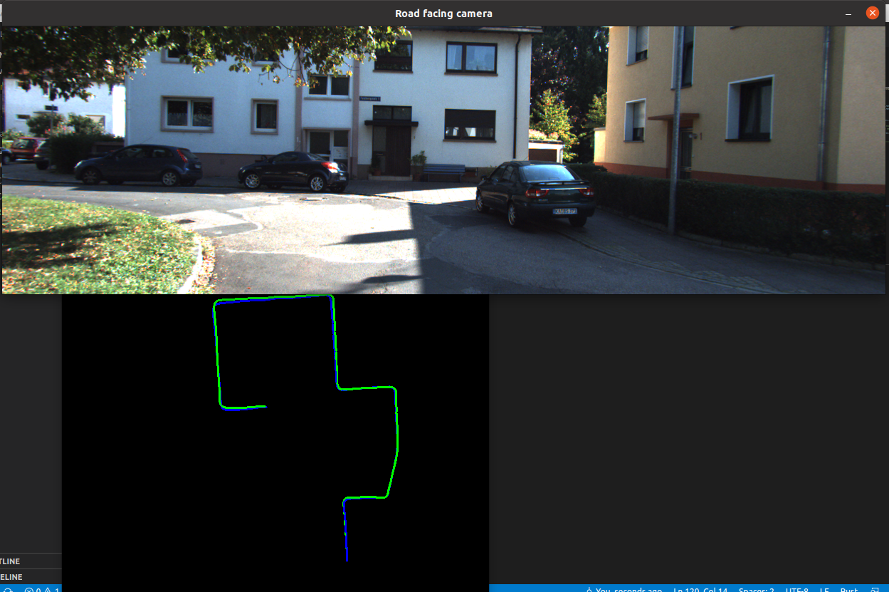
Monocular Visual Odometry in Rust
Feature tracking, pose estimation, and trajectory reconstruction on the KITTI benchmark.
A from-scratch Rust implementation with trajectory diagnostics and KITTI experiments.
Cleaner Bot Coverage Planner
An interactive coverage-planning demo for exploring an initially unknown 2D environment.
Browser-based visualization of a circular BFS-style sweep and coverage behavior.
EBNF Grammar Parser
A Python parser for defining, validating, and inspecting custom Extended Backus–Naur Form grammars.
Built from scratch with grammar inspection and syntax-error reporting utilities.
Reinforcement-Learning Driving Agent
A PyTorch agent that learns start-to-goal navigation on interactive 2D road maps.
Explored reward shaping, lane following, collision avoidance, and training diagnostics.
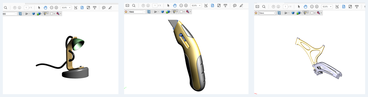
CAD Interoperability Tools
Fusion 360 exporters for portable 3D PDF, 3MF additive-manufacturing files, and Blender-compatible Collada models.
Practical format bridges for visualization, 3D printing, and animation workflows.
Automated License Plate Recognition
A C# detection and OCR pipeline with regular-expression post-correction for traffic imagery.
Early computer-vision research published and presented at ICIAC 2014.